How does it work
What is virtual orienteering and how does it work?
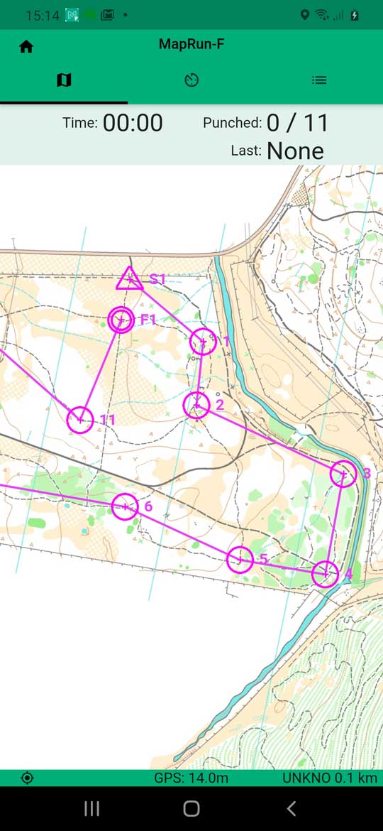 Virtual orienteering is similar to conventional orienteering except that it has no physical control markers. As usual there is a map with the course marked on it showing the start, finish and control locations. You make your way around the course as indicated by the control numbers and the connecting lines.
To verify that you have successfully reached each control point you need a smart phone (Android or Apple) with a GPS, and a free app called MapRun6. When you have completed the course you will have the option of uploading your result to a server so that you can compare your run with others.
1. Download and install the app from Google Play, the App Store, or http://maprunners.weebly.com/
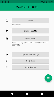
2. Run the app, tap Name, and enter your details
3. If you are in the vicinity of the course you want to run you can tap Events Near Me and select the one you want. Otherwise you can find the course under Select Event > NSW > Armidale.
4. Tap Options and Settings and check out the range of options available.
If you have an older phone with a less sensitive GPS, it is suggested that you increase the Punch Tolerance from 15 to say 30 metres. If the phone does not immediately register your presence at a control you may still need to move around a bit. Modern phones seem to work just fine with a 15 m tolerance.
You may also want to turn off Automatically Upload Results. You can still manually upload the results later if you wish.
5. Optionally, you can download a copy of the map so you can print it. You may find it more convenient to navigate with a paper version of the map and keep your phone in a pocket.
6. When you are ready to start, tap Go to Start and you are on your way. As you pass the start and each control point, the phone will beep and/or vibrate and the control circle will turn from purple to green.
7. When you reach the finish, the app will stop recording and display your route on the screen.
8. If you have to abandon the course, tap the home button at top left and then tap exit.